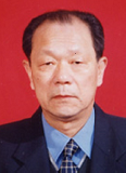

Prof. Jiayao Wang

Prof. Jiayao Wang
Academician of Chinese Academy of Engineering
Henan University, China
Brief Introduction
Chinese cartographer and geoinformation engineering expert, academician of Chinese Academy of Engineering. Born in 1936 in Wuhan, Hubei Province. Currently, he is a professor of Henan University, doctoral supervisor, President of Henan Institute of Spatio-Temporal Big Data Industry Technology, director of Henan Collaborative Innovation Center of Smart Central Plains Geographic Information Technology, executive director of Chinese Society of Surveying and Mapping, Chairman of the Working Committee of Chinese Society of Surveying and Mapping, and chairman of Henan Society of Surveying and Mapping. He was a member of the 9th CPPCC of Henan Province, a member of the Subject Assessment Group of the Academic Degree Committee of The State Council (the 4th and 5th sessions), a member of the Council of the Chinese Society of Surveying and Mapping and chairman of the Cartography and Geographic Information System Committee (the 4th, 5th and 6th sessions), deputy director of the Academic Degree Committee of Henan Province, a member of the Academic Committee of the State Key Laboratory of Surveying and Mapping and Remote Sensing Engineering (Wuhan University), and a national university of higher learning Member of the Surveying and Mapping Teaching Steering Committee, member of the Expert Advisory Committee of the Military Products Finalization Committee of the Central Military Commission of The State Council, member of the Expert Advisory Committee of the Top-level design and promotion Engineering of the integrated electronic information system of the whole Army. In the 1970s, he presided over the preparation and establishment of the first computer cartography major in China; in the mid-1980s, he presided over the establishment of the map database and application major; in the mid-1990s, he presided over the establishment of the Geographic information engineering major, which developed the cartography major into the cartography and geographic information engineering major. He has presided over and completed more than 20 national and military key scientific research projects, covering the fields of modern cartography theory, geographic information system, geographic information network/grid service, digital city and smart city, space-time big data and its application. In 2001, he was awarded the "National Outstanding Scientific and Technological Worker", and in 2002, he was awarded the professional and technical Contribution Award of the whole Army. He has won 1 second prize of National Science and Technology Progress Award, 1 first prize of national and military teaching Achievement Awards, 4 first prizes of military Science and Technology Progress Award, and 1 first prize of Natural Science Award of Henan Province (book category). Awarded the second class once and the third class three times. Fifteen academic works have been published publicly, among which Principles and Methods of automatic Cartographic Synthesis of Digital Maps (1998), Principles of Spatial Information System (2001), Principles and Methods of Cartography (2006) have been awarded the first prize of Excellent teaching materials for surveying and mapping majors of national universities. He has published more than 150 academic papers.
